Mineral Creek
Falls
This is one
of the sweetest 2 mile hikes in New Mexico...!!!
Do not visit
any New Mexico waterfall during a drought
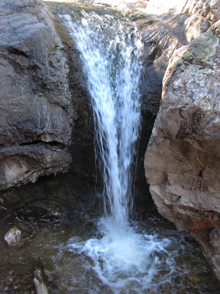
Mineral Creek Falls is
splendid and 40’ high
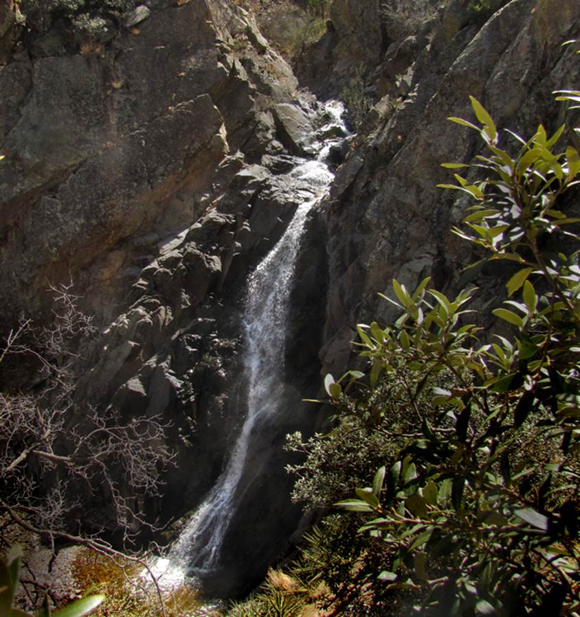
Mineral Creek Falls is a two
mile hike upstream from the parking at Forest Road 157
Then in between your
wheels and the falls is 30’ wide Mineral Creek Arch...!!
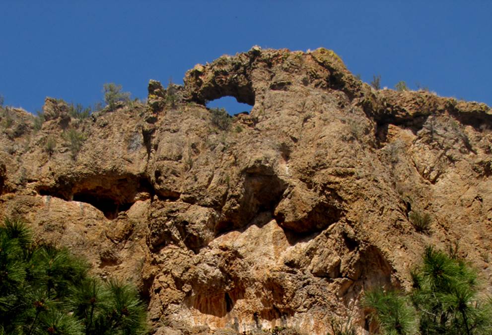
...and half way between
the parking and the natural arch is the 12’ high lower falls
beta facts:
name- Mineral Creek Falls
height- 40’
elevation- 6789’
GPS coordinates-
±32°58’13.879”N 107°44’19.432”W
flow- USGS topos call this stream perennial, but it could go dry
during extra dry years
season- March, April and August
thru October
accommodations- none
ownership- Gila National Forest
access- this is a 2 mile hike, mostly
trail until last ¼-mile rock-hopping
nearest town- Kingston is about 4.5 miles south of here
fun fact- This is a place that I shall make return
visits to...!!!
essay bro
Even after
the forest fire has burned this whole area..... it is still a
WAY beautiful place.......!!!
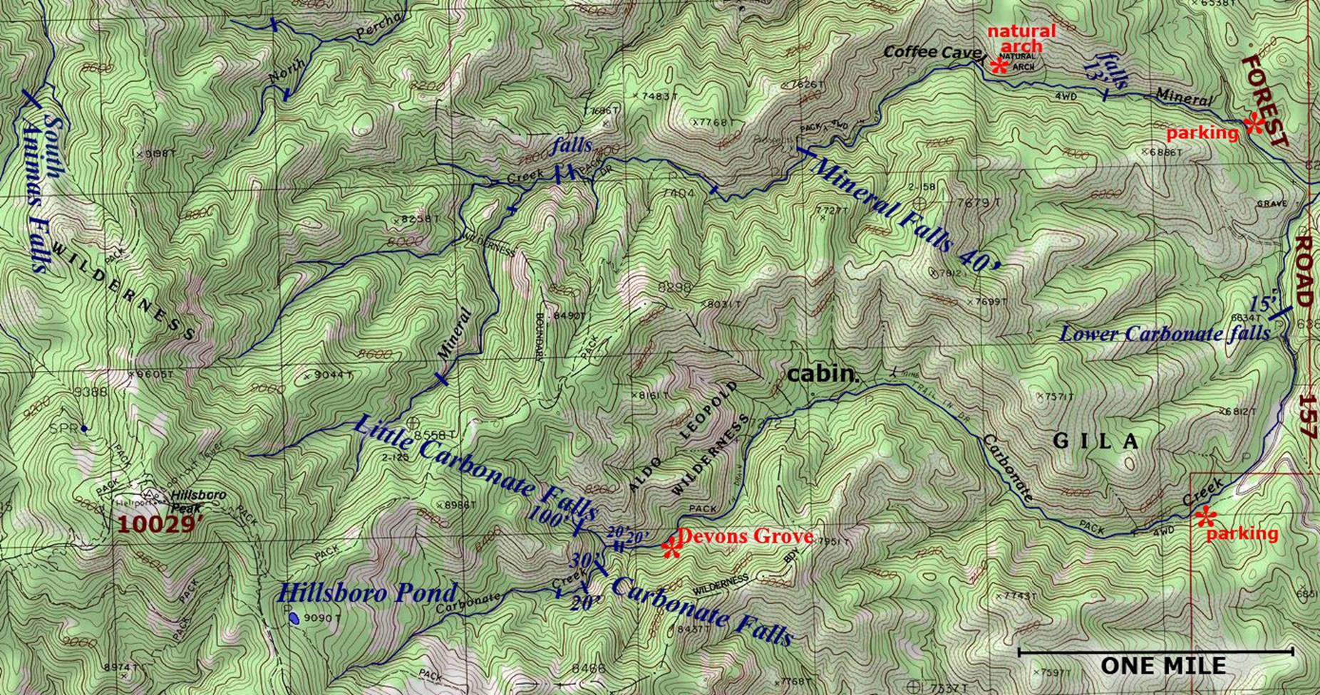
***Friends of mine have wonderful photos of their visit to Coffee
Cave, which is near the Mineral Creek Natural Arch. See the map below. It has beautiful but very fragile calcite formations…
stalactites & stalagmites… and it is gated and locked for its protection. The USFS requires you register your visit
with them and they will provide you with a key for your legal entry. Headlamps are a must.
...Also Devon Fletcher has
some unfortunate “news” about this area: http://southernnewmexicoexplorer.blogspot.com/
Please feel
free to right-click-save-as on the map below to save yourself a hard copy
Enhanced USGS 7.5’ topo map
Send questions and comments to dscott@TheMarbleSculptor.com